
Hoffman Estates ZIP Coverage
Two current postal anchors appear repeatedly in official Village address samples, while several other numbers need careful labels. The table separates current Hoffman Estates delivery examples from historic routing and Census geography. A ZIP code directory should preserve those differences instead of turning every nearby code into a present-day residential claim.
| Code | Hoffman Estates relationship | Routing context | How to use it |
|---|---|---|---|
| 60169 | Main current label in Village directory and parcel examples | USPS materials associate it with Hoffman Estates processing | Verify each address; it is not the whole village |
| 60192 | Current label in north-side office and residential examples | USPS materials document Hoffman Estates use and older realignments | Validate the full address with USPS |
| 60179 | Historic, unique Sears-related commercial code | Legacy grouping with 60192 and 60195 | Do not assume current residential delivery |
| 60195 | Neighboring or historic routing context | USPS material records deliveries shifted to 60192 | Use as a history clue, not a current blanket code |
| 60191 | Appears in routing-container context | Container language references Hoffman Estates 60169 | Not proof of delivery within the village |
| 60010, 60067, 60107, 60118, 60120 | Census ZCTAs touching the place profile | Statistical areas, not postal routes | Use for Census comparisons only |
The precise share of village land within each delivery code and the station serving every address were not established in the research. That gap matters. Use the USPS ZIP Code Lookup for a specific address rather than guessing from a business directory, map label, or nearby suburb.
Two Hoffman Estates ZIP Anchors
Official Village directory samples show 60169 on addresses such as West Golf Road, Jennifer Lane, Knoll Lane, and Hassell Court. A Cook County sample parcel card also uses 60169. These examples make it the strongest main code in the Hoffman Estates ZIP code directory, but examples do not define a complete boundary.
Other Village business-directory entries use 60192 on West Higgins Road and Hoffman Boulevard. USPS materials tie that number to Hoffman Estates and preserve the history of routing changes in the area. For either code, the street number and street name remain essential. A person searching only “60169” or “60192” will capture postal territory beyond any one neighborhood and cannot infer who lives at a given parcel.
Note: The official examples establish address usage, not a complete roll of households, post-office stations, or municipal acreage by code.
Verify a Hoffman Estates ZIP
The Postal Service is the authority for current delivery coding. Enter the full street address, city, and state in its address lookup. Preserve the standardized result, including directional letters, unit format, and ZIP+4 when supplied. For a place-only search, treat returned city-and-state codes as candidates that still require an address check.
| USPS input | Why it matters |
|---|---|
| Street address | Connects the query to one deliverable location. |
| Apartment or unit | Distinguishes delivery points within one building. |
| City and state | Tests the postal city label rather than the municipal line. |
| ZIP Code | Supports a reverse city-by-code check when the number is known. |
The USPS lookup screen below is the sole successful image assigned to this page.
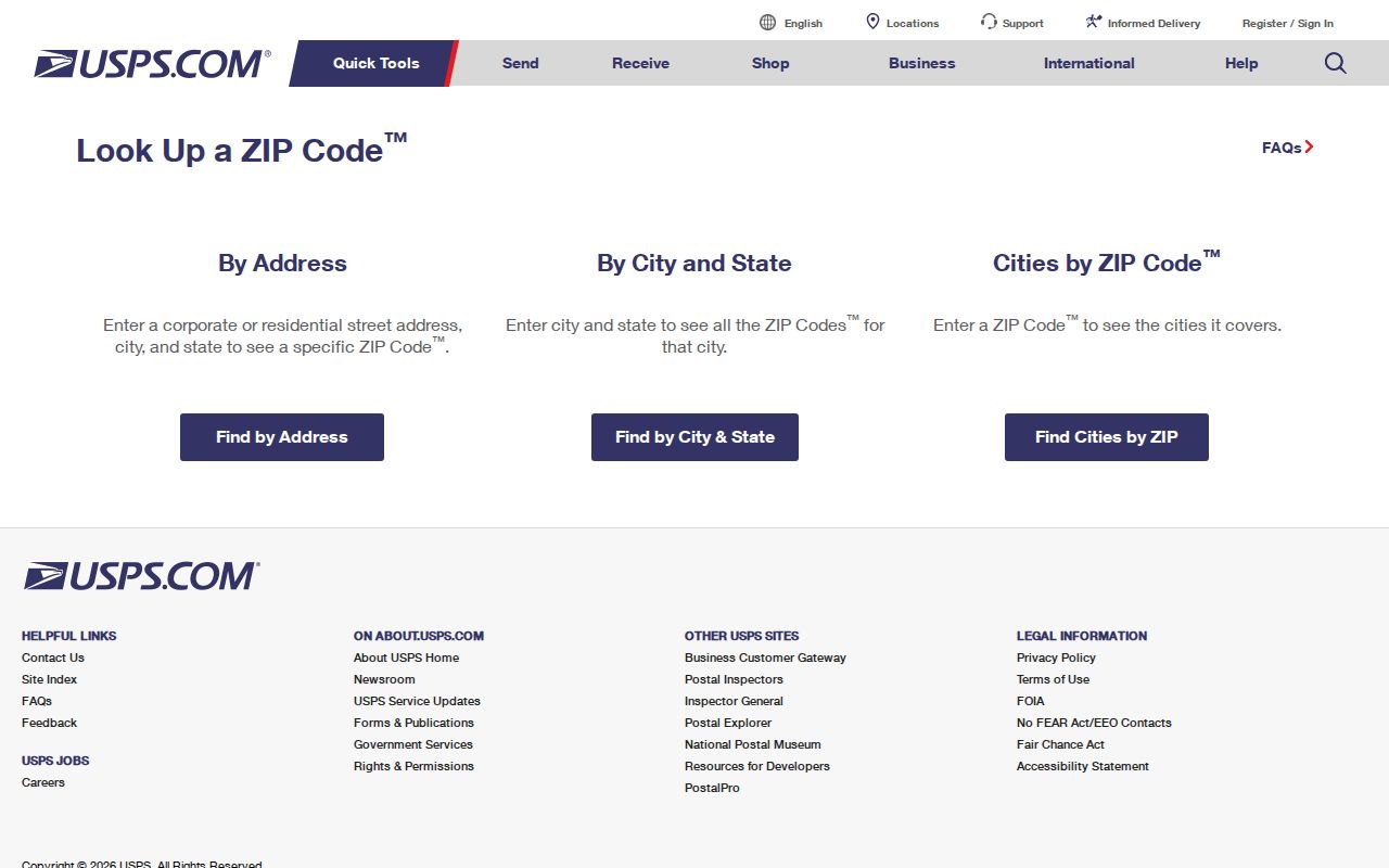
The standardized output should be carried into county and Village searches. It still does not decide whether the parcel lies inside Hoffman Estates or which county keeps its deed.
Search Hoffman Estates by ZIP
No inspected county or Village portal publishes a ZIP-wide list of residents. The ZIP code directory works as a narrowing tool. The Illinois voter form uses a five-digit code, but only as part of an individual registration check. Cook and Kane property systems rely more heavily on the street address, city, parcel number, or owner name.
- Standardize the exact address through USPS. Save both the five-digit code and any ZIP+4 result.
- Resolve Cook or Kane County through the parcel map. Search Cook by address or PIN, and Kane by site address or parcel.
- Compare the situs address with the tax-mailing line. An owner’s correspondence address may be elsewhere.
- For an individual election-service check, enter the required name, birth date, five-digit code, street number, and selected street in the Illinois lookup.
- Once the correct street is known, use the Hoffman Estates street directory for the address-keyed record chain.
This sequence keeps a postal clue in its proper role. It narrows geography but does not replace parcel, deed, directory, or identity evidence.
Hoffman Estates Portal Filters
The Illinois Registration Lookup is the only inspected resident-related form that requires a five-digit ZIP. Its first pass also requires first name, last name, and birth date. Street number and a populated street-name dropdown follow. That design checks one registration; it is not a ZIP roster and does not show a whole household.
Cook County Assessor Address Search uses house number, direction, unit, street, and city, with PIN and other property paths available. Kane County Property Tax Inquiry exposes house number, street name and type, city, parcel, owner, sales, and advanced searches, but no ZIP filter was visible in the main form. CookViewer searches address, intersection, or PIN. Village BS&A searches by record type, address, name, or parcel. None should be described as a ZIP-wide people search.
Historic Hoffman Estates ZIP Routing
The 60179 code belongs in the Hoffman Estates ZIP code directory because official postal material connects it to the former Sears complex. Its value is historical and commercial, not proof of a current residential zone. The 60195 code also belongs in a transition note because USPS material documents deliveries moving or realigning to 60192. Routing references involving 60191 describe container handling and do not establish that number as a present village delivery code.
Old newsletters, company records, directories, or deeds may retain one of these labels long after postal handling changed. Preserve the code exactly as printed, then verify the street address in current USPS data and county parcel records. This guards against dropping a relevant historic source merely because its ZIP no longer matches modern mail.
Hoffman Estates ZCTAs Are Statistical
Census profiles can associate Hoffman Estates with ZCTAs 60010, 60067, 60107, 60118, and 60120. A ZIP Code Tabulation Area, or ZCTA, is a Census approximation built for statistics. It does not assign mail and should never replace an address result from USPS. ZCTA edges can touch or overlap the place profile while the delivery label belongs to another suburb.
Use those areas for population, demographic, or regional comparisons only. When the goal is a resident or parcel, return to the full address. The village sits amid Schaumburg, Elk Grove, Streamwood, Barrington, and other postal geographies, so a broad statistical match can be accurate for a table and still be wrong for a letter or county record.
Hoffman Estates Address Grid Shift
A major 1978 change complicates older ZIP searches. Ordinance 1017-1978 created a uniform grid effective August 1. Roughly 6,000 residents received new addresses, and 92 street names or segments were affected. The plan tied into Schaumburg’s grid, used Roselle and Schaumburg Roads as a center, and applied about 800 numbers per mile. The post office began using new addresses that June and delivered old-address mail for about a year.
An old directory line can therefore carry a former street name, former number, and old postal context while pointing to the same modern parcel. Library history gives Kingman-to-Kankakee and Maywood-to-Maricopa examples. Bridge the old and new address through the ordinance history, PIN, subdivision, lot, block, and legal description. A ZIP match alone cannot repair the change.
Match Hoffman Estates Address Forms
Keep a small address ledger when moving from a ZIP code directory to public records. Copy the USPS-standardized address first. Next, record the county parcel’s situs line, PIN, subdivision, lot, and block. Then save the taxpayer mailing line separately. Finally, transcribe the legal description from the deed index. These fields may disagree without any record being wrong because each serves a different job.
For most Hoffman Estates parcels, CookViewer can locate an address, intersection, or PIN and show nearby parcel context. The Kane side uses Kane DevNet and KaneGIS4 for address, parcel, subdivision, and map work. Village GIS adds its own address locator and community-service geography. When a postal city, municipal line, or county seems inconsistent, the PIN and legal description are the safest bridge.
A tax bill sent outside Hoffman Estates does not relocate the parcel. Nor does a Hoffman Estates delivery label prove incorporation. Preserve each label beside its source and date.
Hoffman Estates ZIP Boundary Limits
USPS draws delivery routes, while the Village and counties draw government boundaries. Hoffman Estates also crosses Cook and Kane Counties. A Hoffman Estates mailing label may fall outside the incorporated line, and a parcel inside the village may carry a neighboring postal city label. That mismatch decides which assessor, recorder, court, or election office holds a record. Confirm the municipal and county location independently from the ZIP.
A useful ZIP code directory also distinguishes three address forms. The situs is the physical parcel location. The mailing address is the destination for tax or other correspondence and may be off-site. A legal description identifies the land by subdivision, lot and block, or section-based text. Deeds follow the legal description and parcel key even when street and postal labels change.
- ZIP and ZIP+4
- The five-digit code marks a delivery area. Four added digits narrow the mail to a smaller segment or delivery point.
- PO-box ZIP
- A code used for post-office boxes rather than a mapped residential street area.
- Unique ZIP
- A code assigned to one large organization or destination with enough mail volume.
- Carrier route
- A postal delivery path within a ZIP, not a city, precinct, or parcel boundary.
Boundary check. Verify USPS delivery, Village limits, county, and parcel separately before connecting a Hoffman Estates ZIP code to any resident record.